
Light Pollution Map - Dark Sky
5.3.0 by Dunbar Technology, LLC (0 Reviews) November 02, 2025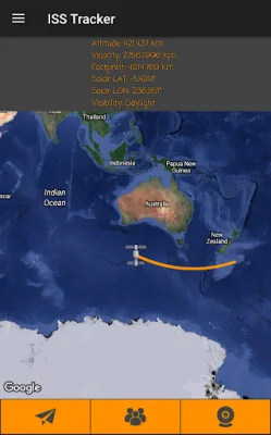
Latest Version
5.3.0
November 02, 2025
Dunbar Technology, LLC
Education
Android
0
Free
com.pa.lightpollutionmap
Report a Problem
More About Light Pollution Map - Dark Sky
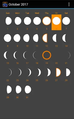
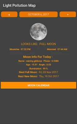
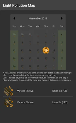
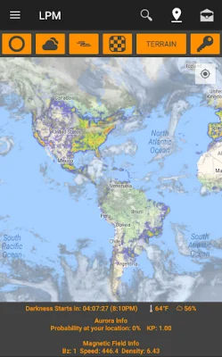
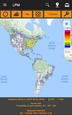
The Light Pollution Map app is a comprehensive tool for stargazing enthusiasts. It offers a variety of features to help users find the best locations for viewing the night sky, including a light pollution map overlay, cloud cover map, and temperature indicator. Users can also track the International Space Station and receive alerts for upcoming meteor showers, super moons, and lunar eclipses. The app also provides information on the moon's phases and rise and set times, as well as live data on aurora activity and magnetic fields.
One of the unique features of the app is the ability to save and load favorite dark sky locations, making it easy for users to return to their preferred stargazing spots. The app also includes a "horizon safe radius tool" to help users avoid light pollution on the distant horizon. Additionally, users can overlay an Aurora layer on the light pollution map to see the best locations for viewing the Northern Lights.
The app also offers a variety of astronomy calculators and access to live aurora webcams from around the world. Users can also explore live images of the sun from NASA's Solar and Heliospheric Observatory and view a new astronomy photo every day. The app even has widgets that can be placed on the home screen for quick access to information on aurora activity, cloud cover, and more.
In addition to its many features, the app also offers a night mode and AMOLED themes to reduce light pollution and save battery life while stargazing. Some features may require an additional in-app purchase, but the app offers several upgrade packs and a monthly subscription with a free trial. With its comprehensive features and user-friendly interface, the Light Pollution Map app is a must-have for anyone interested in stargazing and astronomy.
Rate the App


Popular Apps